Construction projects face major risks when underground utilities are unknown or poorly mapped, leading to delays, accidents, and costly budget overruns. Subsurface Utility Engineering (SUE) reduces these risks by systematically identifying and mapping utilities before construction begins.
Every construction crew and landscaper should understand SUE and its range of quality levels for safer projects. Keep reading to learn about SUE, its benefits, quality levels, and more.
What Is Subsurface Utility Engineering?
Subsurface Utility Engineering (SUE) represents the professional investigation of underground utilities to support safe and efficient project design. SUE combines advanced technology, field expertise, and systematic data collection to create accurate maps of existing underground infrastructure. This type of mapping addresses the challenge of unknown utilities that plague construction projects across all sectors.
The primary purpose of SUE extends beyond simply locating utilities. Professional SUE services offer comprehensive utility risk assessments, conflict analyses, and data management, supporting informed decision-making throughout project development. SUE practitioners utilize specialized equipment, including Ground Penetrating Radar (GPR), electromagnetic locating systems, and vacuum excavation technology, to gather precise information about utilities.
The Four Quality Levels of SUE
You must understand SUE quality levels for safer projects. SUE services operate within a standardized framework of four quality levels, designated as Quality Levels A through D. These levels build upon each other systematically, with each successive level providing increased accuracy and reliability. The quality level designation system enables project teams to understand the confidence level associated with utility location data and make informed design decisions based on the quality of the information.
Each quality level serves specific project requirements and risk tolerance levels. Lower quality levels provide general awareness of utility locations suitable for preliminary planning, while higher quality levels deliver exact utility locations for precise design and construction.
Quality Level D: Gathering Record Data
The first SUE quality level is D, which forms the foundation of investigations by gathering utility information from various sources, including digital databases, paper records, internet research, site inspections, and interviews with knowledgeable personnel. This process can reveal incomplete or conflicting data about underground utilities, offering limited site coverage and an incomplete picture of subsurface infrastructure. Despite these gaps, Quality Level D data provides necessary context for further field investigations.
While imperfect in detail, Quality Level D data is valuable for preliminary project planning, enabling initial awareness of utility requirements and identifying areas that require more thorough investigation. The resulting preliminary utility drawings indicate reliability limitations, ensuring project teams understand the scope and accuracy of the information provided.
Quality Level C: Surveying Visible Utility Features
Quality Level C enhances utility investigations by systematically surveying visible utility features on a project site. This process involves locating and measuring above-ground infrastructure, including manholes, valve boxes, and meter installations. Survey crews verify existing survey data and identify discrepancies between record information and field conditions, which uncover any conflicts that highlight areas needing further investigation. While Quality Level C provides accurate horizontal positioning for visible utilities, it cannot determine the exact routing of underground infrastructure between these features.
Professional surveyors combine Quality Level C data with information from Quality Level D to create utility drawings that clearly indicate the quality level of each utility feature. This comprehensive dataset improves utility awareness and pinpoints areas of uncertainty, guiding the need for higher-level investigations.
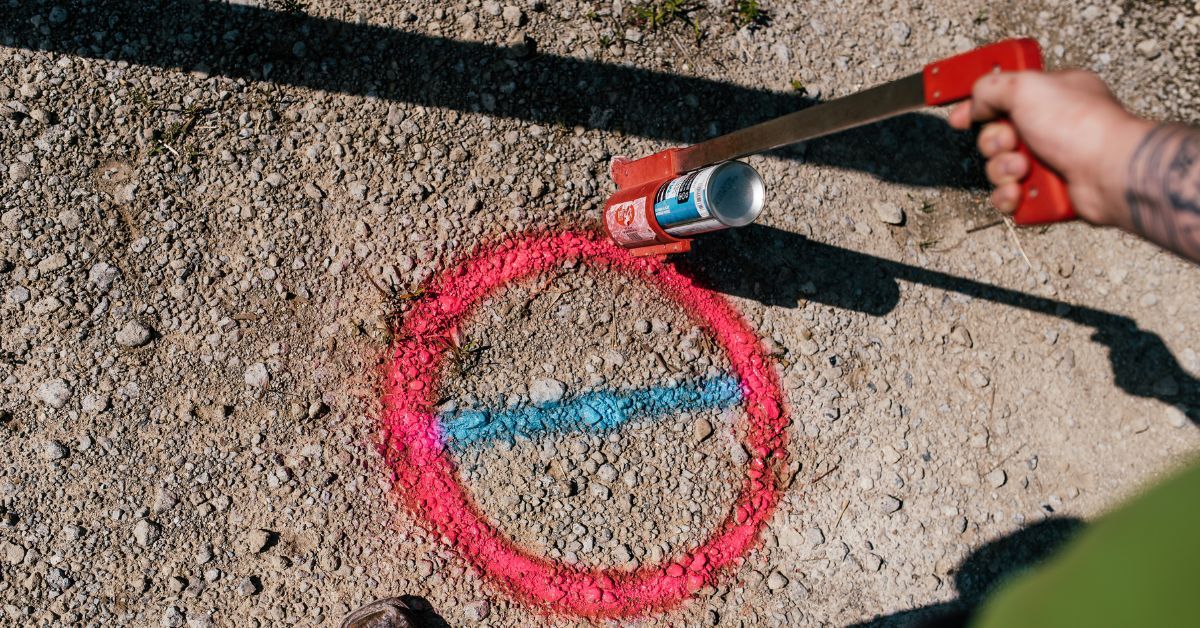
Quality Level B: Designating Underground Utilities
Quality Level B is the first active step in underground utility investigation, using electromagnetic locating equipment to trace utilities and mark their approximate horizontal positions on the ground. This process relies on surface geophysical methods, temporary surface markings, and information from 811 utility notification systems and private locating services. Professional technicians survey these markings and incorporate the data into project drawings, building on prior Quality Level D and C findings.
This level provides critical utility awareness for project planning and preliminary design, though its approximate nature introduces limitations in accuracy. Marked utility locations are interpretations of subsurface conditions rather than exact positions and therefore require tolerance zones to account for potential discrepancies.
Quality Level A: Physical Location and Visual Identification
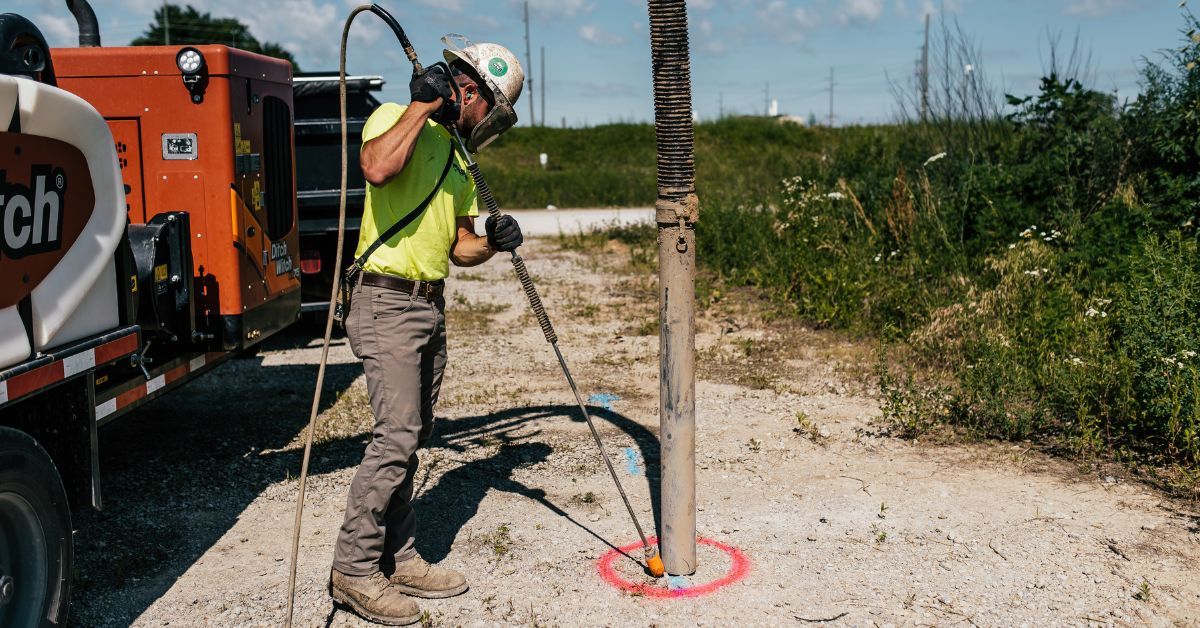
The highest accuracy in utility investigations is Quality Level A, which physically exposes and visually identifies underground utilities. Using vacuum excavation technology, also known as potholing or daylighting, locators create small excavations to safely expose utilities for direct observation and precise measurement. Survey crews record the exact horizontal and vertical positions of utilities, typically measuring to the top of pipes or conduits, thereby eliminating the uncertainty associated with geophysical interpretation methods.
This precise data forms the basis for detailed design and construction planning. Accurate utility locations allow for effective conflict analysis, informed utility relocation planning, and reliable construction sequencing. Marked as Quality Level A on project drawings, this verified information ensures confidence in the accuracy of utility locations for designers and project teams.
The Comprehensive Benefits of SUE Services
Utilizing subsurface utility locating provides many benefits to construction crews and excavators before they start working. Enlisting SUE services for a project means a more accurate design, fewer construction costs, a safer worksite, and more.
Reduced Construction Costs
SUE services deliver substantial cost reductions through the prevention of utility-related construction delays and conflicts. Accurate utility mapping enables designers to avoid utility conflicts during the design phase, eliminating costly field changes and construction delays. The early identification of utility conflicts enables planned utility relocations, which cost significantly less than emergency relocations during construction.
Improved Design Accuracy
Comprehensive utility information enables more accurate project design that accounts for existing underground infrastructure. Designers can optimize project layouts to minimize utility conflicts, reduce construction complexity, and improve overall project efficiency. Quality utility data supports informed decision-making throughout the design process.
Fewer Change Orders
Accurate utility mapping significantly reduces the number of construction change orders from unexpected utility encounters. Contractors can plan construction activities with confidence in utility location information, reducing the risk of costly design modifications during construction. This predictability benefits project budgets and construction schedules.
Enhanced Safety
SUE services contribute to improved construction safety by identifying potentially hazardous utilities before excavation begins. Knowledge of gas lines, electrical systems, and other dangerous utilities enables appropriate safety planning and protective measures. This proactive approach reduces the risk of utility strikes that can cause injuries, fatalities, and environmental damage.
Accessing Professional SUE Services
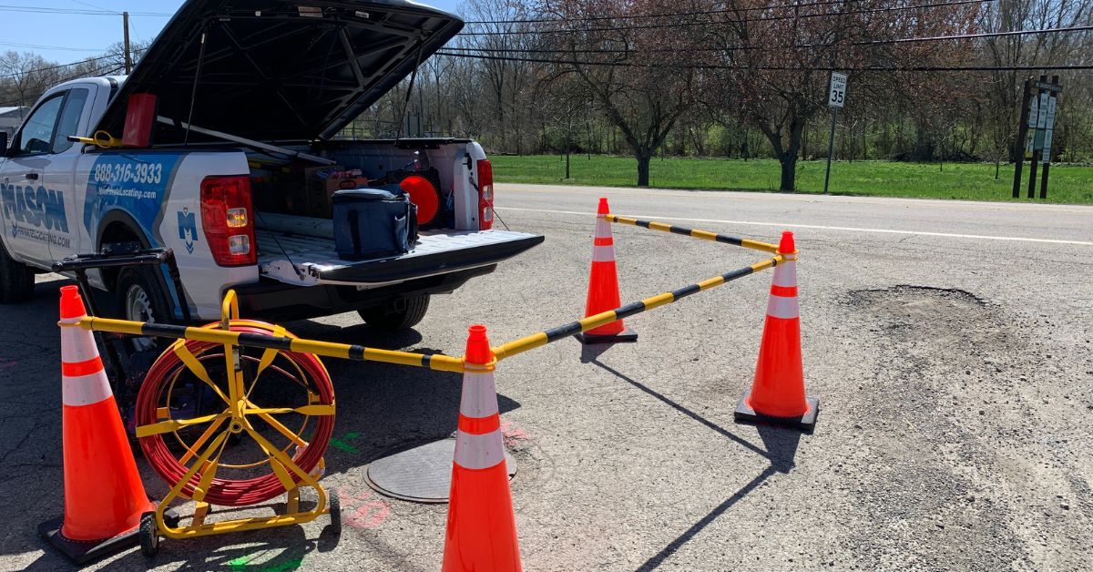
If your next project could benefit from SUE services, we can help. Mason Private Locating (MPL) offers comprehensive SUE Field Services across all four quality levels. Using advanced technology, such as GPR, electromagnetic locating systems, and vacuum excavation equipment, MPL delivers accurate utility data to support construction and engineering projects. Our experienced team ensures precise utility investigation for reliable project outcomes.
MPL's one-stop-shop approach streamlines SUE Field Service delivery through coordinated field crews capable of performing multiple quality levels in a single visit. This integrated model reduces project coordination needs while maintaining consistent data quality.
Implementing SUE for Project Success
Familiarizing yourself with SUE quality levels will help your project teams make informed decisions about utility investigation needs and budget allocation. Early implementation of SUE services during planning maximizes the benefits of accurate utility data, reducing costs, improving safety, and enhancing project delivery.
Professional SUE services become a valuable investment and provide a competitive edge in today's construction landscape by matching investigation intensity to project risk and budget. Contact MPL today if your project requires high-quality SUE services.